The second leg of my October road trip is Dallas to Phoenix, and I wanted the same treatment I gave the first leg: skip the guessing and actually verify what the fastest route passes. Turns out it’s a meteor crater ranked among the largest of its kind in the country, a cave two guys kept secret from the entire state of Arizona for 14 years, and a four-story adobe building that’s been standing since around 1350.
The fastest path is I-20 west out of the Dallas-Fort Worth area through Abilene, Midland, and Odessa, merging onto I-10 west of Pecos and running the rest of the way through El Paso, Las Cruces, Tucson, and into Phoenix — about 1,065 miles, roughly 18 hours of straight driving. Like the Charlotte-to-Dallas leg, that’s genuinely a two-day trip, not a one-day one. This list is ordered geographically along that route, counted down from #7 (the first worthwhile stop leaving Fort Worth) to #1 (the arrival highlight approaching Phoenix).
7. Fort Worth Stockyards National Historic District, Fort Worth, TX
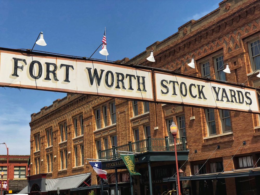
Right off I-30/I-20 leaving the Metroplex: a 98-acre National Register Historic District (listed 1976, 46 contributing buildings) built around the former Fort Worth Union Stockyards, which opened January 19, 1890 and by 1907 was selling a million head of cattle a year. The livestock business held on until the 1950s, when auctions moved closer to where cattle were actually raised. Today it’s shopping, saloons, and rodeo — and weather permitting, volunteers still drive a herd of Texas longhorns down Exchange Avenue twice a day, a tradition revived for the city’s 1999 sesquicentennial. Sources: Wikipedia, fortworthstockyards.org.
6. Odessa Meteor Crater, Odessa, TX
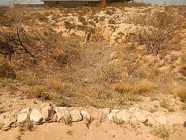
Practically on I-20 itself, about 3 miles south at Exit 108: a genuine meteorite crater, 550 feet across, estimated at roughly 63,500 years old. A Texas historical marker on-site calls it the second-largest crater of its kind in the United States and sixth-largest in the world, behind the much more dramatic Meteor Crater near Winslow, Arizona. More than 1,500 meteorite fragments have been recovered from the surrounding area since a rancher first found one in 1921, though excavation of the crater itself confirmed there’s no buried meteorite mass underground. It was originally about 100 feet deep; windblown soil has filled it to roughly 15 feet today, which makes it a low-key sight in person but a legitimately rare one — it’s a designated National Natural Landmark. Sources: Wikipedia, on-site Texas Historical Commission marker.
5. Monahans Sandhills State Park, TX
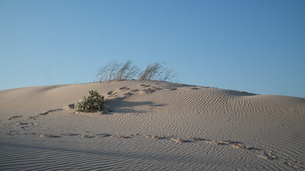
A short detour off I-20: 3,840 acres of genuine sand dunes, some up to 70 feet high, part of a dune field that stretches 70 miles long and 20 miles wide from Crane County to Andrews County. Despite the look, it’s technically not a desert — it’s a semi-arid ecosystem with about 12 inches of rain a year and enough groundwater to support mule deer, coyotes, and the Havard oak, a shrub-sized oak species that grows almost entirely underground except for a few feet of branches poking through the sand. The park opened to the public in 1957, and the state leases the land from the Sealy-Smith Foundation on a 99-year term running through 2056. Source: Wikipedia.
4. Franklin Mountains State Park, El Paso, TX
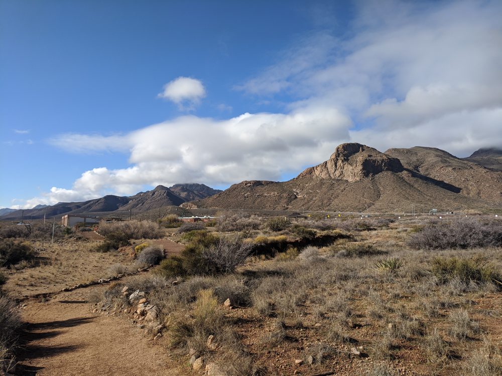
Visible from I-10 the entire way through El Paso: at 24,247 acres, one of the largest urban parks in the US lying completely within a city’s limits, with North Franklin Mountain topping out at 7,192 feet. Pictographs and mortar pits show people have used the mountain pass here for more than 12,000 years. A developer built a road into the mountains in 1979 hoping to put housing on them; a local coalition talked the Texas Legislature into protecting the land instead that same year, though lawmakers pointedly refused to fund the park for years afterward. It finally opened to the public in 1987. Sources: Wikipedia, Texas Parks and Wildlife Department.
3. Kartchner Caverns State Park, AZ
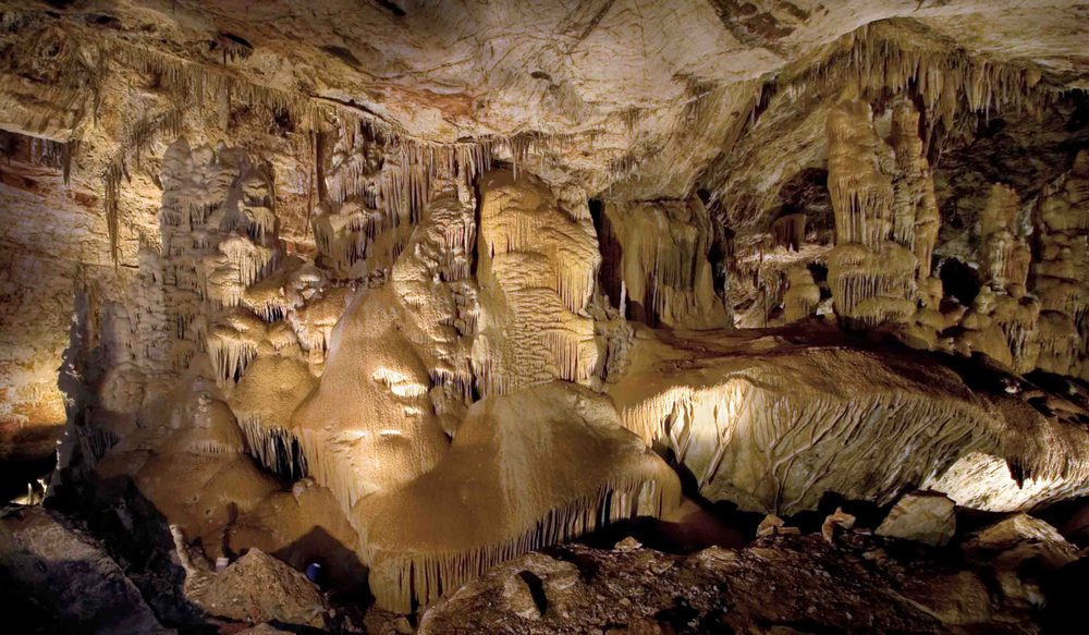
A short detour off I-10 near Benson: cavers Gary Tenen and Randy Tufts found this cave in 1974 after crawling on their bellies toward the smell of bat guano, then kept its location secret for 14 years to protect it from vandalism while they worked with the landowning Kartchner family and the state to turn it into a park instead. Arizona spent $28 million on airlock doors, misting machines, and other systems to preserve the cave’s humidity before it finally opened to the public in 1999. It’s a genuinely “living” cave — the formations are still growing, including one of the world’s longest soda-straw stalactites at just over 21 feet and a 58-foot column called Kubla Khan. The Big Room closes April 15 through October 15 each year because it doubles as a maternity roost for cave bats. Source: Wikipedia.
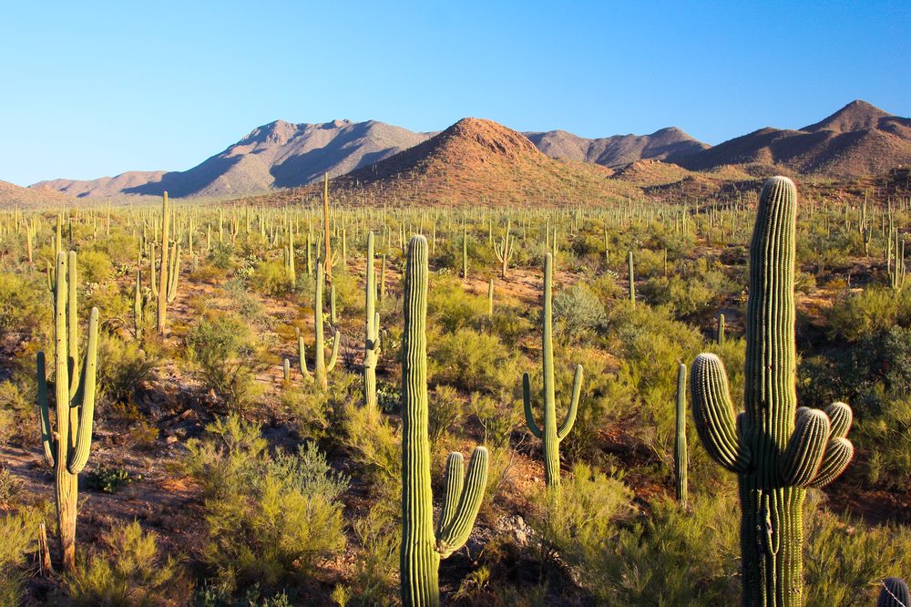
2. Saguaro National Park, Tucson, AZ
About 10 miles off I-10 on either side of Tucson: 92,000 acres split into two districts flanking the city, protecting Sonoran Desert habitat for the saguaro, the giant cactus that doesn’t grow wild anywhere else on Earth. A mature saguaro can take 50 to 70 years to grow its first arm, live to 200 years old, and weigh up to 4,800 pounds fully hydrated. President Hoover protected the eastern Rincon Mountain District by proclamation in 1933; President Kennedy added the western Tucson Mountain District in 1961; Congress upgraded the combined site to full national park status in 1994. The park is home to an estimated 1.8 million saguaros. Sources: Wikipedia, nps.gov/sagu.
1. Casa Grande Ruins National Monument, Coolidge, AZ
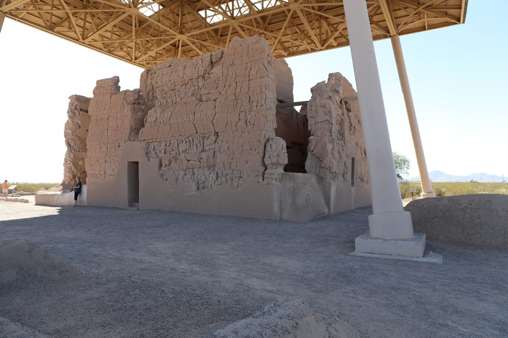
The arrival highlight, about an hour outside downtown Phoenix: a four-story building the Hohokam people constructed out of caliche (a natural desert cement), most likely around 1350 CE — one of the largest prehistoric structures ever built in North America, and archaeologists still don’t fully know what it was for. It’s the largest known structure of the Hohokam culture, who farmed the Gila Valley and built extensive irrigation canals and trade networks that lasted over a thousand years, until around 1450 CE. Spanish missionary Father Eusebio Kino was the first European to document it, in November 1694, naming it “Casa Grande” — Spanish for “big house.” In 1892, the 480 acres around it became the first prehistoric and cultural site ever protected by the US government; it was upgraded to a national monument in 1918. The steel shelter roof overhead, built in 1932, replaced an earlier wooden one from 1903 — visitors can walk up to the Great House but not inside it, to protect what’s left of the roughly 700-year-old walls. Sources: Wikipedia, nps.gov/cagr.
Seven stops across three states and about 1,065 miles — from a stockyards sign built for cattle drives that still happen twice a day, to a four-story adobe building that’s been standing since around 1350. Worth the two days, same as leg one.