This is a different path than the Dallas-to-Phoenix route covered a couple weeks back. Discovery #112 and #113 ran I-20 west out of Fort Worth, then I-10 the rest of the way, through Abilene, Midland-Odessa, El Paso, and Tucson. This one goes somewhere else entirely: north out of Dallas on US-287, west on I-40 through the Texas Panhandle, central New Mexico, and northern Arizona, then a final stretch on US-93/I-11 over the Hoover Dam Bypass into Las Vegas.
The route runs US-287 north out of the Dallas-Fort Worth area through Decatur, Bowie, Wichita Falls, Vernon, Childress, and Clarendon, merging onto I-40 west at Amarillo, then I-40 the rest of the way through Tucumcari, Santa Rosa, Albuquerque, Grants, and Gallup in New Mexico, and Holbrook, Winslow, Flagstaff, Williams, Seligman, and Kingman in Arizona, before picking up US-93 north to the Hoover Dam Bypass and I-11 into Las Vegas — about 1,220 miles, roughly 18 hours of straight driving. Like the Phoenix legs, that’s genuinely a two-day trip, not a one-day one, and there’s almost no overlapping highway with those routes until the very end near the Arizona-Nevada line. This list is ordered geographically along the route, counted down from #10 (leaving Dallas) to #1 (the arrival highlight approaching Vegas).
10. Sixth Floor Museum at Dealey Plaza, Dallas, TX
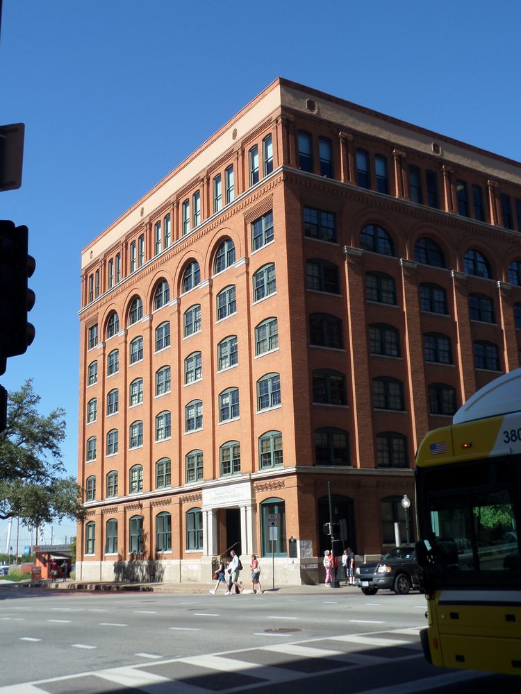
The starting point itself: the former Texas School Book Depository overlooking Dealey Plaza, where President Kennedy was assassinated on November 22, 1963. The building’s top two floors sat empty for decades after the rest was restored to its 1901 appearance and used for administrative offices; the Dallas County Historical Foundation reopened the sixth floor as a museum on Presidents’ Day, February 20, 1989, built around the historic films, photographs, and artifacts of that day. Sources: Wikipedia, jfk.org.
9. World’s Littlest Skyscraper (Newby-McMahon Building), Wichita Falls, TX
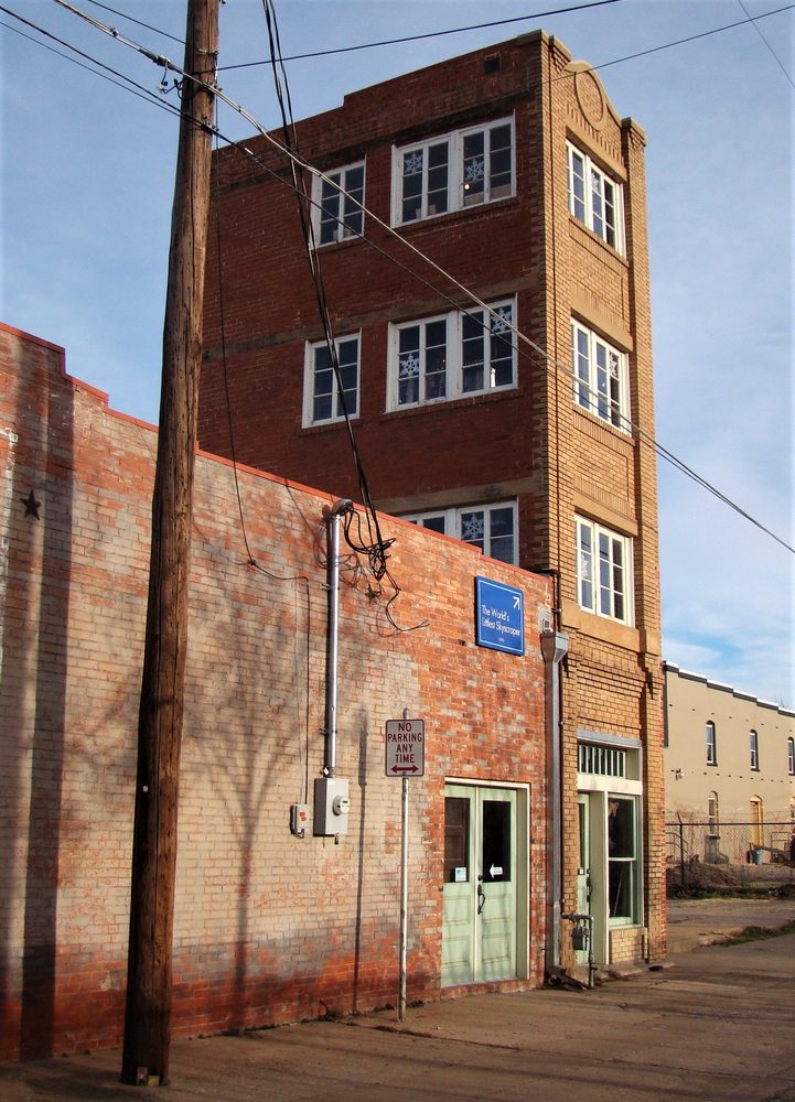
Right off US-287 in downtown Wichita Falls: a four-story brick building, 40 feet tall, completed in 1919, with floor plates only about 9 by 12 feet inside — barely more than a stairwell’s worth of office space per floor. Local legend holds that builder J.D. McMahon swindled his investors out of $200,000 by drawing up blueprints listing the height as 480 inches instead of 480 feet, and that nobody noticed until construction was already finished; the building’s 1919 construction date and genuinely tiny floor plan are well documented, even if the swindle story itself is retold more as local lore than as a court-proven fact. Ripley’s Believe It or Not! gave it the nickname “World’s Littlest Skyscraper” during the 1920s, and it’s stuck ever since. Source: Wikipedia.
8. Cadillac Ranch, Amarillo, TX
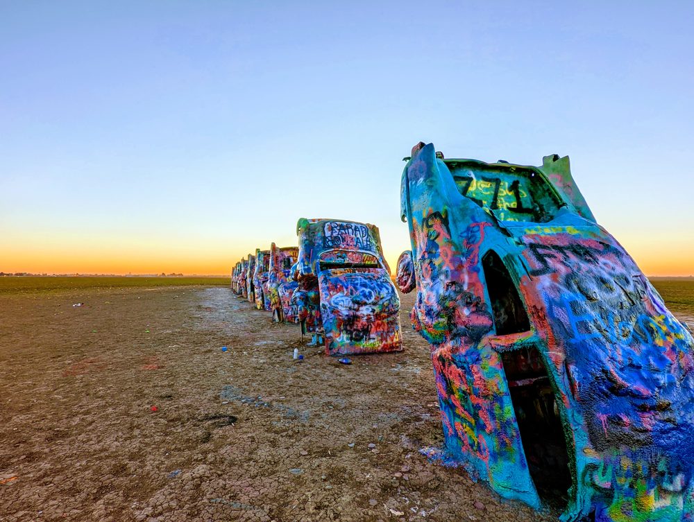
Right off I-40 on the western edge of Amarillo: ten Cadillacs, model years 1949 through 1963, buried nose-down in a field at the same angle as the sides of the Great Pyramid of Giza. The art collective Ant Farm — Chip Lord, Hudson Marquez, and Doug Michels — installed them in 1974, funded by eccentric Amarillo millionaire Stanley Marsh 3. Unlike most public art, visitors are actively encouraged to spray-paint the cars, and the accumulated, ever-changing layers of paint are part of the point. Source: Wikipedia.
7. Palo Duro Canyon (State Park), Canyon, TX
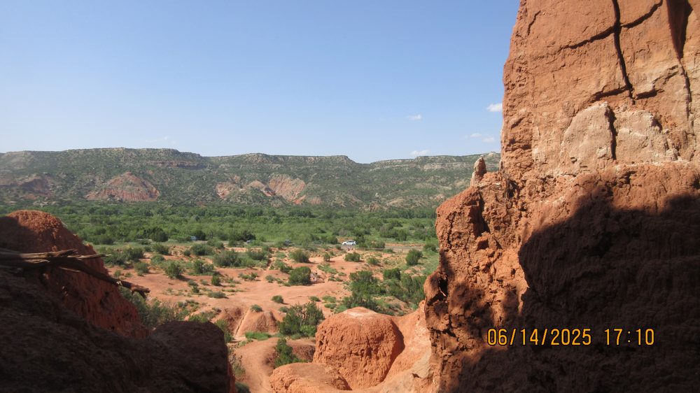
A short detour south of I-40 near Amarillo, in the town of Canyon: Palo Duro Canyon stretches roughly 120 miles long and up to 20 miles wide, cut by the Prairie Dog Town Fork of the Red River into the Caprock Escarpment. Texas Parks and Wildlife calls it the second-largest canyon system in the United States, though its depth is best described as a range — roughly 800 to 1,000 feet deep depending on where it’s measured, per both TPWD and outside geological sources. It’s been a National Natural Landmark since 1976, and the multicolored rock layers have earned it the nickname “The Grand Canyon of Texas.” Sources: Wikipedia, Texas Parks and Wildlife Department.
6. Blue Swallow Motel, Tucumcari, NM
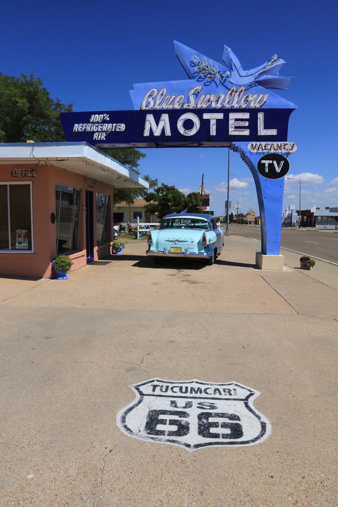
Right on old Route 66 in Tucumcari, just south of I-40: the Blue Swallow Motel is a 12-unit motor court built in 1939 and open to guests since around 1941, one of the longest continuously operated motels on the entire highway. It made the National Register of Historic Places on November 22, 1993, and its turquoise-and-pink neon sign — a swooping swallow above the motel’s name — is one of the most photographed pieces of surviving Route 66 signage on the whole road. Source: Wikipedia.
5. Blue Hole, Santa Rosa, NM
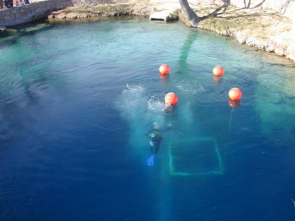
A few minutes off I-40 in Santa Rosa: the Blue Hole is a bell-shaped artesian well and cenote, about 80 feet across at the surface and widening to 130 feet at the bottom, with a main pool more than 80 feet deep down to a metal grate that’s sealed off deeper cave passages since 1976. The water holds a constant 62°F year-round, fed by roughly 3,000 gallons a minute flowing up from the Ogallala Aquifer — enough to completely exchange the pool’s water about every six hours. It’s one of the more popular scuba certification and training sites in the country, despite being a small-town swimming hole in the middle of New Mexico. Source: Wikipedia.
4. Sandia Peak Tramway, Albuquerque, NM
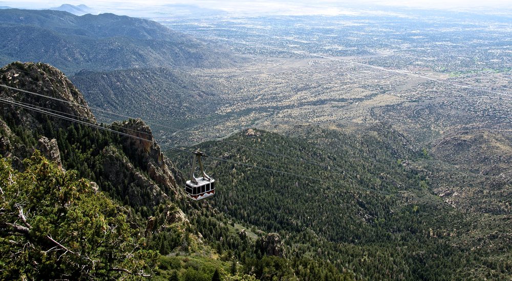
A short detour off I-40 through Albuquerque: the Sandia Peak Tramway is a 2.7-mile aerial tramway that opened May 7, 1966, and remains the longest aerial tram in the Americas today. It was the longest tramway in the world for over four decades, until Armenia’s Wings of Tatev tram surpassed it in 2010. The ride climbs from a base elevation of 6,559 feet to 10,378 feet at the top of Sandia Peak in about 15 minutes, with views stretching across roughly 11,000 square miles of New Mexico on a clear day. Source: Wikipedia.
Bonus: The Pit, University of New Mexico, Albuquerque, NM
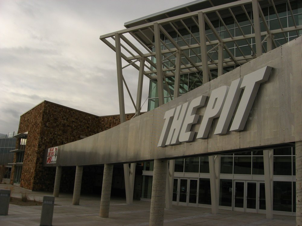
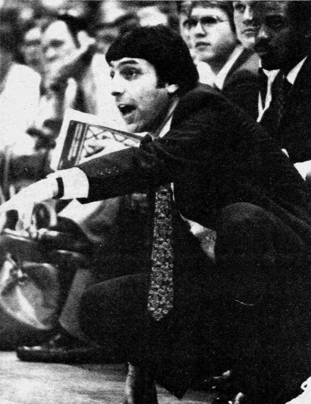
Not officially part of the countdown, but close enough to #4 to be worth a detour: The Pit, on the University of New Mexico campus, hosted the 1983 NCAA Men’s Division I Basketball Championship on April 4. Jim Valvano’s underdog NC State Wolfpack beat a heavily favored Houston team — “Phi Slama Jama,” led by Hakeem Olajuwon and Clyde Drexler — 54-52, on a putback dunk by Lorenzo Charles off an air-balled desperation shot by Dereck Whittenburg at the buzzer. Valvano’s frantic post-game sprint around the court looking for someone to hug remains one of the most replayed clips in tournament history. The arena earned its nickname the ordinary way: the playing floor sits dug in, roughly 37 feet below street level. Sources: Wikipedia, Wikipedia.
3. Petrified Forest National Park / Painted Desert, near Holbrook, AZ
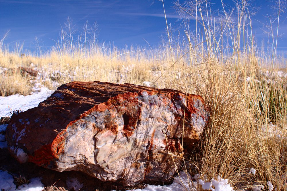
I-40 runs directly through part of the park itself, near Holbrook: Petrified Forest National Park protects fossilized logs from trees that lived in the Late Triassic, roughly 225 million years ago, later buried and slowly replaced mineral-by-mineral with solid quartz. The federal government first protected the site as a national monument in 1906, one of the earliest sites protected after the Antiquities Act, and Congress upgraded it to full national park status in 1962. The same colorful Chinle Formation that preserved the logs also gives the adjoining Painted Desert its banded reds, purples, and grays. Source: Wikipedia.
2. Standin’ on the Corner Park, Winslow, AZ
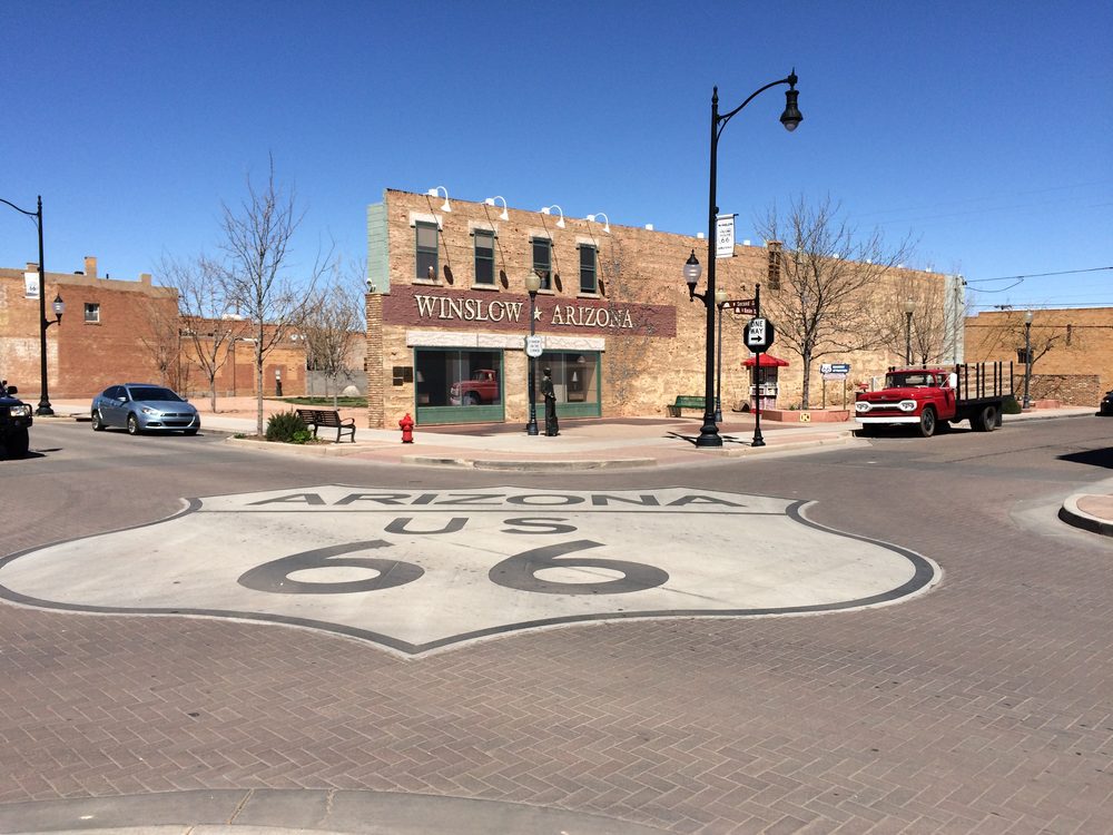
Right off I-40 in downtown Winslow: a small park built entirely around one line from the Eagles’ 1972 song “Take It Easy” — “standin’ on a corner in Winslow, Arizona” — dedicated in 1999. It’s anchored by a bronze statue called “Easy,” by sculptor Ron Adamson, standing with a guitar in front of a two-story trompe-l’oeil mural, with a real flatbed Ford parked at the curb for good measure. A low wall of memorial bricks, each donated and inscribed by a visitor, surrounds the whole park. Source: Wikipedia.
1. Hoover Dam, Boulder City, NV
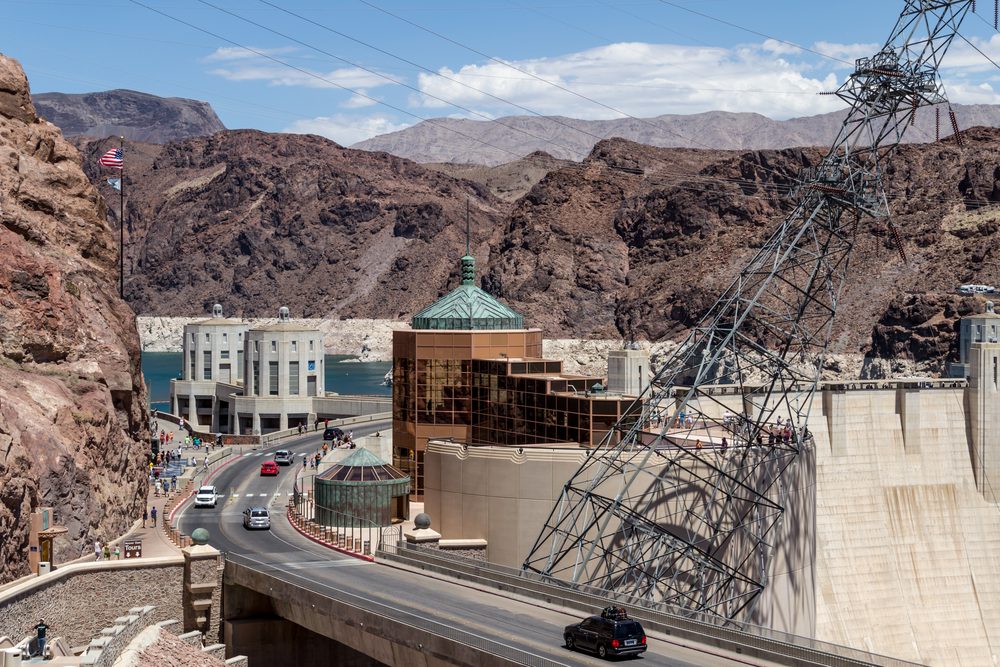
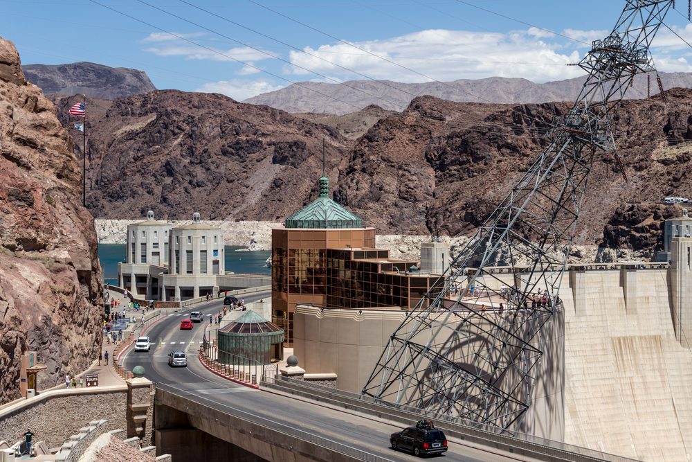
The arrival highlight, right on the Arizona-Nevada line: Hoover Dam stands 726 feet tall and 1,244 feet across, built between 1931 and 1936 during the Great Depression and dedicated on September 30, 1935 by President Franklin D. Roosevelt. It ranked among the tallest dams in the world when it was completed, a record that concrete dams this size don’t hold onto forever as bigger ones get built elsewhere. Traffic no longer crosses the dam itself — since the four-lane Hoover Dam Bypass opened on October 19, 2010, US-93 traffic crosses the Colorado River on the Mike O’Callaghan–Pat Tillman Memorial Bridge, 1,500 feet downstream, before merging onto I-11 for the final stretch into Las Vegas. Source: Wikipedia.
Ten stops across four states and about 1,220 miles — from a downtown building sized in inches instead of feet to a concrete wall that once held back the entire Colorado River. A genuinely different two-day drive than the Phoenix leg, with almost no overlap until the final approach into Vegas.