Nine straight days of Vegas-area posts (Discoveries #120 through #128) wrap up today, and this one marks the turn: Ken’s pointing this series toward Reno next, starting with the drive itself. Before assuming US-95 the whole way was actually the standard route rather than just the obvious-looking line on a map, I ran it through OSRM’s routing engine myself — Las Vegas to Reno comes back at 431 miles, about 8.5 hours of straight driving, on US-95 north through Beatty, Goldfield, and Tonopah, then Alt-95 through Yerington and Silver Springs to Fernley, then I-80 into Reno. That matches multiple independent travel write-ups pulled the same way, and it matches something better than any of them: Nevada’s own tourism board runs an official road-trip itinerary over this exact corridor, branded the “Free-Range Art Highway,” listing Las Vegas, Beatty, Goldfield, Tonopah, Hawthorne, Yerington, Fallon, and Reno as its communities and citing 440 to 515 miles depending on detours — my own OSRM number lands right at the low end of that range. Source: Wikipedia, U.S. Route 95 in Nevada; travelnevada.com, Free-Range Art Highway; OSRM routing data.
One more thing worth verifying rather than assuming: this is a different route from the famous Extraterrestrial Highway (SR-375), the alien-themed loop that also starts near Las Vegas and happens to touch Tonopah — that’s a separate, roughly 470-mile loop trip back to Vegas, not part of this one-way drive to Reno, per travelnevada.com’s own road-trip list. And per a specific, non-negotiable requirement for this post: if the route passes through or near a town with a currently licensed, operating legal brothel, it belongs on the list, handled factually rather than salaciously — exactly like any other real, regulated local business along a rural highway. More on how that was verified at #11 below. Counted down from #11 (the first real stop leaving the Las Vegas Valley) to #1 (the last town before Reno), so the numbers roughly trace the actual drive south to north.
11. Amargosa Valley, NV — A Licensed Brothel Verified Still Open, Right on US-95
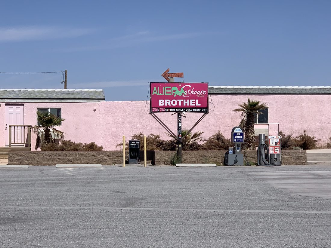
Nevada is the only U.S. state that permits legal, county-licensed brothels, and per Wikipedia’s own “Prostitution in Nevada” page, 10 of the state’s 17 counties currently allow them — though only 6 counties actually have an active one operating today. Nye County, which covers the first three stops on this route (Amargosa Valley, Beatty, and Tonopah), is one of the six. Rather than assume any brothel along this corridor is currently open, this was checked three independent ways: against Wikipedia’s own “List of brothels in Nevada”, against the business’s own live site (copyright-dated 2026, a working phone number, hours posted as 10am–4am for walk-ins and 24 hours by appointment), and against an independent industry report, Brothel Nevada’s “Nevada Brothel Status Report 2026,” published August 2026, which lists 16 currently operating legal brothels statewide and names the Alien Cathouse specifically, with 16 separate publicly documented courtesan affiliations there in 2026 alone. All three agree: it’s open, right on US-95 in Amargosa Valley, about 87 miles out of the Las Vegas Valley — the first real stop on this drive. One honest address wrinkle on the business’s own site, flagged rather than picked arbitrarily: its footer lists 5390 US-95, while its own structured page data elsewhere shows 2703 US-95 — a minor discrepancy in the site’s own listings, not something this post is resolving on its behalf.
Two other candidates along this same stretch were checked and correctly left off the list. Cottontail Ranch, a brothel that once sat near Lida Junction in neighboring Esmeralda County (and reportedly hosted visits from Howard Hughes in 1967), closed for good in 2004 when its madam retired, per Wikipedia — and Esmeralda County, Goldfield’s county, has had zero active brothels since 2016. The Wild Cat Brothel in Mina, Mineral County, directly on US-95 between Tonopah and Hawthorne, is also not included: its Google Business Profile lists it as “Temporarily Closed,” and it does not appear among Brothel Nevada’s 16 currently operating properties either. Sources: Wikipedia, Prostitution in Nevada; Wikipedia, List of brothels in Nevada; aliencathouse.com; Brothel Nevada, Nevada Brothel Status Report 2026.
10. Beatty, NV — The Real Gateway to Death Valley
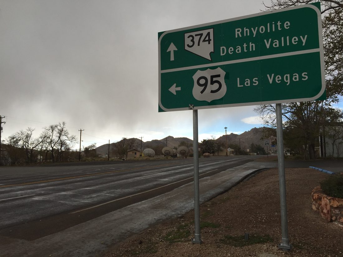
Per Wikipedia, Beatty was laid out in 1904–05 and named for “Old Man” Montillus Beatty, a Civil War veteran who ranched along the Amargosa River and became the town’s first postmaster. It boomed as the railhead for the Bullfrog Mining District (Rhyolite included), and today calls itself — accurately — the Gateway to Death Valley: SR-374 splits off US-95 right in town and reaches Death Valley National Park in about 8 miles. One small, honestly odd fact worth including because it’s true and easy to verify: per Wikipedia, the Beatty Library is the only library in Nevada housed in a geodesic dome. Source: Wikipedia, Beatty, Nevada.
9. Rhyolite Ghost Town & the Goldwell Open Air Museum
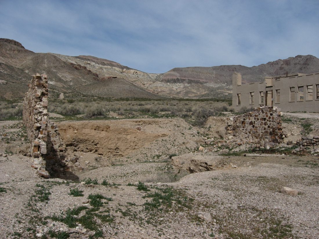
Per Wikipedia, Rhyolite sprang up in January 1905 after Frank “Shorty” Harris and Ernest “Ed” Cross struck gold nearby, and by 1907–08 it had electric lights, water mains, telephones, a hospital, an opera house, and a stock exchange, with scholarly population estimates in the 3,500-to-5,000 range. It emptied almost as fast as it filled: the mine closed in 1911, the last train left in 1914, and the 1920 census counted just 14 residents. The ruins — including the railroad depot and a house built from 50,000 discarded bottles — are maintained today by the BLM. Immediately south, on private land, the Goldwell Open Air Museum grew out of a single 1984 sculpture, “The Last Supper” by Belgian artist Albert Szukalski; a later piece, “Tribute to Shorty Harris” by Fred Bervoets, depicts the actual prospector whose 1904 strike started the whole boom. Sources: Wikipedia, Rhyolite, Nevada; travelnevada.com, Free-Range Art Highway.
8. Goldfield, NV — Nevada’s Former Largest City, Population 225 Today
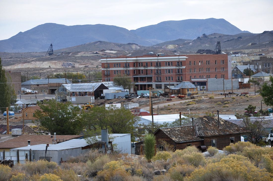
Per Wikipedia, gold was discovered at Goldfield in 1902, and by 1906 it had grown to roughly 20,000 people — briefly Nevada’s largest city, big enough to host a world lightweight boxing championship fight that year. Wyatt and Virgil Earp both arrived in 1904; Virgil worked as a deputy sheriff until his death from pneumonia in October 1905. A 1923 fire destroyed most of the town’s wooden buildings, but the brick 1907–08 Goldfield Hotel survived and has sat unoccupied since the end of World War II. Today Goldfield is the Esmeralda County seat with a population of 225 as of the 2020 census, down from a peak near 20,000. Source: Wikipedia, Goldfield, Nevada.
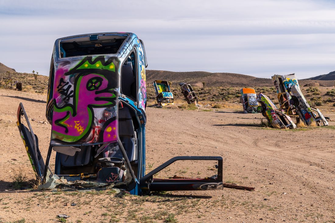
7. International Car Forest of the Last Church
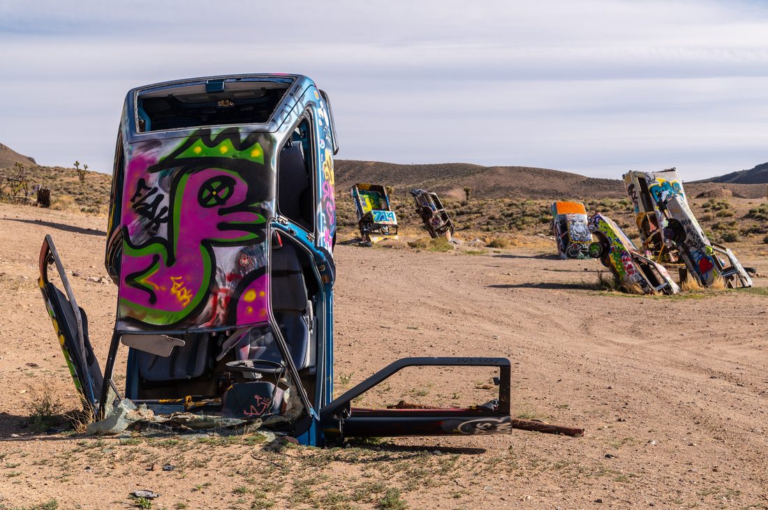
Per Nevada Magazine (Travel Nevada’s own publication), roughly 40 vehicles — cars, trucks, vans, even a school bus — stand buried nose-down or stacked in a dirt lot on the edge of Goldfield, each hand-painted by visiting artists. The installation started when Goldfield resident and artist Mark Rippie planted the first vehicle vertically in the ground; fellow artist Chad Sorg saw it, was inspired, and moved to Goldfield in 2011 to help expand the project into what exists today. It’s free, open to the public year-round, and reached via dirt roads just east of US-95. Source: Nevada Magazine, Only In Your State: International Car Forest of the Last Church.
6. Tonopah, NV — The Mizpah Hotel and a Lady in Red Who Never Checked Out
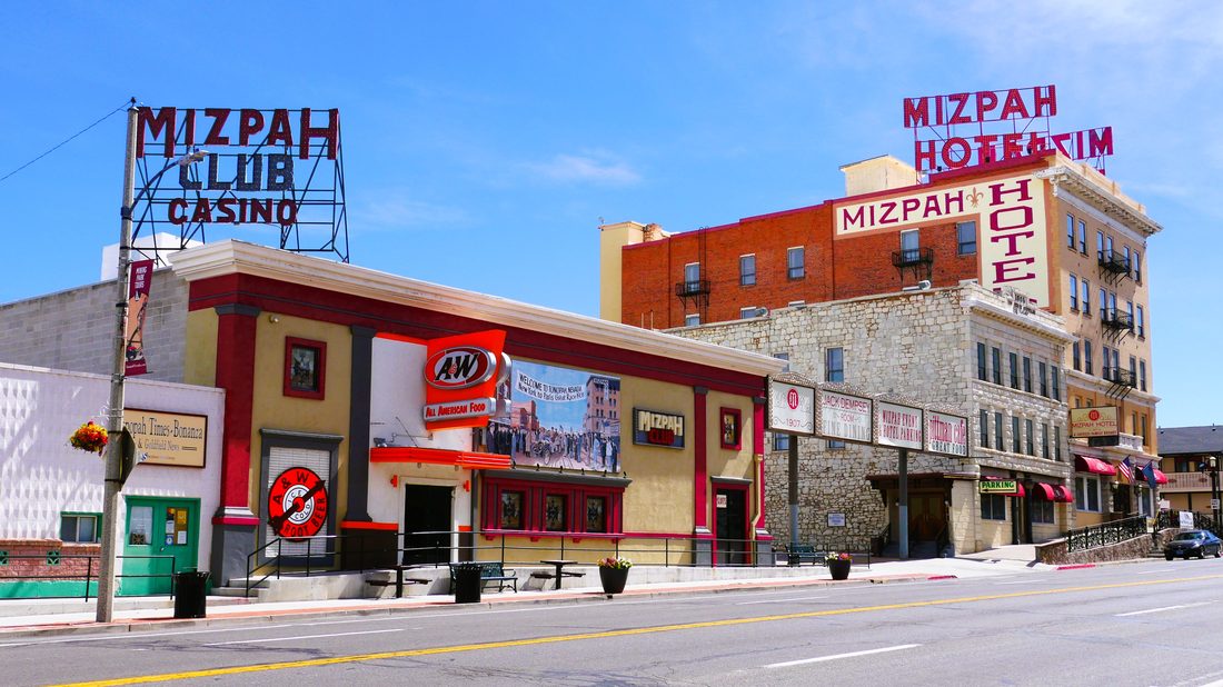
Per Wikipedia, prospector Jim Butler’s 1900 silver strike founded Tonopah, which sits at the junction of US Routes 6 and 95, roughly midway between Las Vegas and Reno. Construction on the Mizpah Hotel began in 1905 and finished in 1908; it was once the tallest building in Nevada. Checked directly against its own current site rather than assumed still open: the Mizpah is a fully operating hotel today, bookable online, with rooms including a “Lady in Red Suite” named for the hotel’s most famous ghost legend and a “Jack Dempsey Suite” honoring the boxing champion, who is said to have worked at the Mizpah as a bartender and bouncer early in his career. Sources: Wikipedia, Tonopah, Nevada; themizpahhotel.com.
5. Tonopah After Dark — USA Today’s #1 Stargazing Park, Next Door to a Motel With 4,000+ Clowns
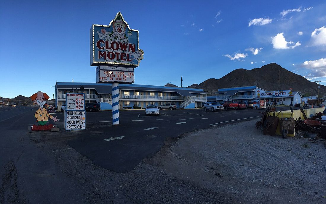
Per Travel Nevada’s own stargazing page, the Tonopah Stargazing Park — free, open 24/7, managed by the Town of Tonopah — has been named the #1 stargazing destination in America by USA Today, with more than 7,000 stars visible to the naked eye on a moonless night thanks to minimal light pollution. A short walk from downtown sits the Clown Motel, opened in 1985 by Leroy and Leona David in honor of their late father’s collection of clown statues, and located directly next to the historic Tonopah Cemetery. Per Wikipedia, new ownership since 2019 has expanded the collection to more than 4,000 pieces of clown memorabilia under the “World Famous Clown Motel” name — it’s been featured as a haunted location on Travel Channel’s Ghost Adventures and Most Terrifying Places in America. Sources: travelnevada.com, Tonopah Stargazing Park; Wikipedia, Clown Motel.
4. Hawthorne Army Depot — 2,427 Bunkers South of Walker Lake
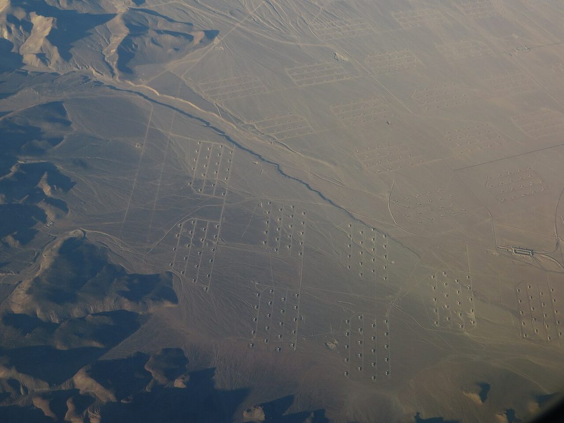
Per Wikipedia, the depot was established as a Navy ammunition facility in 1930, after a 1926 disaster at a New Jersey depot led Congress to order a new site built more than 1,000 miles from the coast. It transferred to Army control in 1977 and covers 147,000 acres with 2,427 bunkers — commonly cited, including on Wikipedia’s own Walker Lake article, as the world’s largest ammunition depot. It sits in Mineral County, directly south of Walker Lake, and the free Hawthorne Ordnance Museum in town lets visitors see decommissioned ordnance up close. Sources: Wikipedia, Hawthorne Army Depot; travelnevada.com, Free-Range Art Highway.
3. Walker Lake — A Remnant of Ice-Age Lake Lahontan That’s Lost 90% of Its Volume
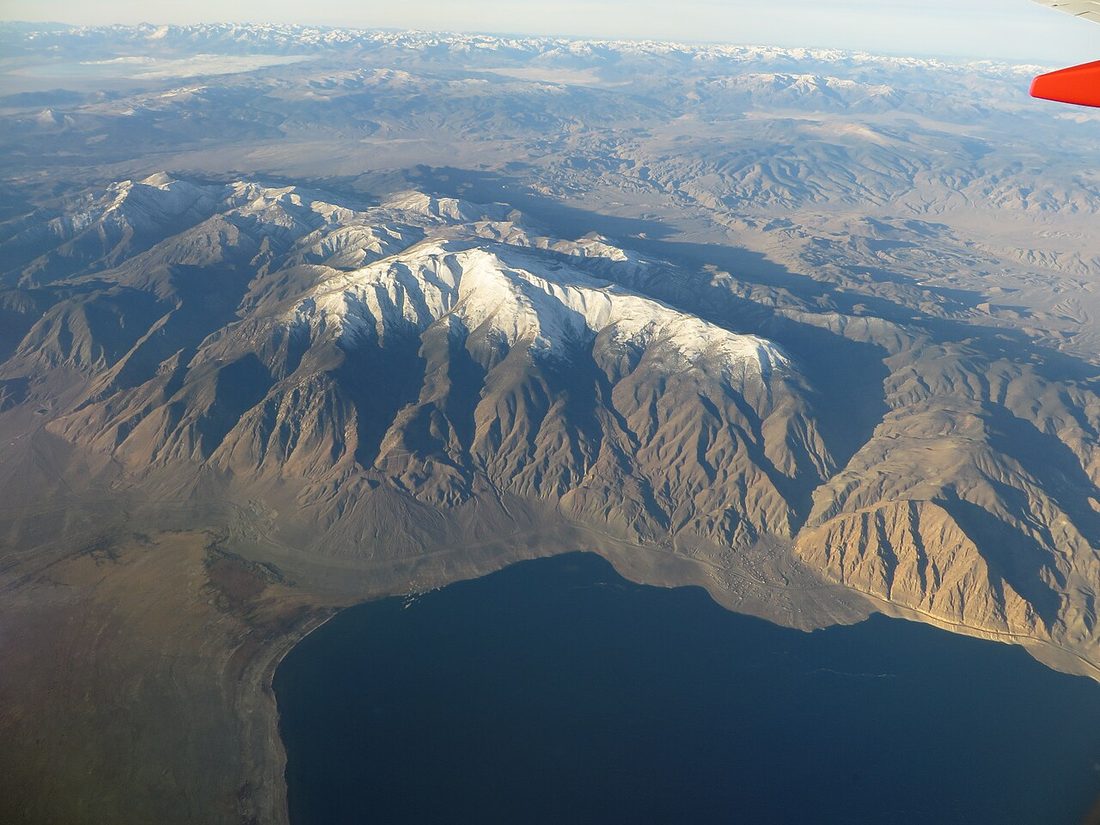
Per Wikipedia, Walker Lake’s basin is a remnant of prehistoric Lake Lahontan, the vast ice-age lake that once covered much of northwestern Nevada, and US-95 runs directly along its western shore. It’s a genuinely hard-luck story worth telling honestly rather than glossing over: more than a century of upstream irrigation diversions have left the lake down about 90% in volume and more than 50% in surface area since the 1850s, with salinity now too high to support fish life at all. The Walker Basin Restoration Program has been buying back water rights since 2009, and delivered water to the lake for the first time in 2019 — real, ongoing progress, though the lake has not recovered. Source: Wikipedia, Walker Lake (Nevada).
2. Yerington & Silver Springs — Mason Valley’s Onion Farms and a Melting Adobe Fort
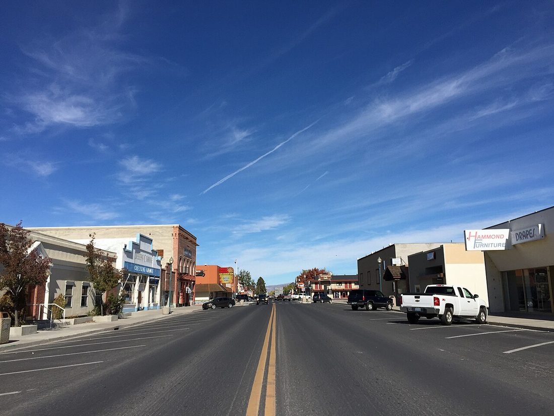
Per Wikipedia, Yerington is the Lyon County seat, sitting on Alt-95 about 33 miles south of Silver Springs. Mason Valley around it is genuinely agricultural: Peri & Sons Farms, headquartered in Yerington since 1979 per its own National Onion Association grower profile, farms thousands of acres and ships more than 450 million pounds of onions a year, including its own proprietary Sweetie Sweet variety. About 33 miles north, Silver Springs sits at the junction of US-50 and Alt-95; Fort Churchill State Historic Park, 9 miles south of that junction, preserves the eroding 1860 adobe ruins of a real frontier fort built to protect Pony Express and telegraph routes, next to the Lahontan Reservoir and State Recreation Area. Sources: Wikipedia, Yerington, Nevada; National Onion Association, Peri & Sons Farms; Wikipedia, Silver Springs, Nevada.
1. Fernley, NV — The Last Town Before Reno, and One of Amazon’s First Fulfillment Centers on Earth
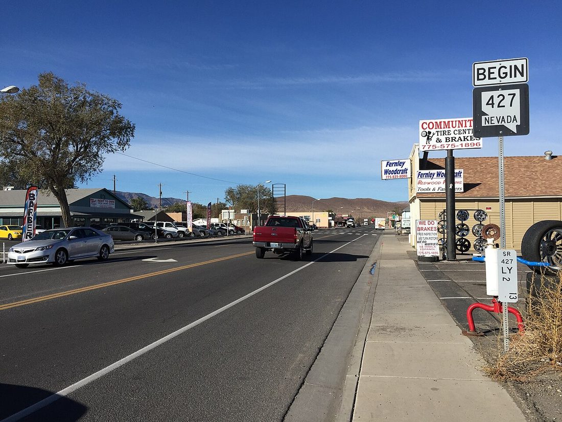
Per Wikipedia, Fernley was established in 1904 as an agricultural community fed by the Newlands Irrigation Project, incorporated as a city in 2001, and is Nevada’s 7th most populous city today at 22,895 residents (2020 census). Two genuinely surprising, verified facts anchor the final stretch: Fernley was home to one of the first Amazon.com order-fulfillment centers in the world, a 750,000-square-foot facility that opened in 1999, and the world’s first Tesla Gigafactory sits 15 miles west at the Tahoe Reno Industrial Center, directly along the I-80 route into Reno. From here it’s I-80 west, and Reno itself — the subject of its own upcoming post — is the anchor at the end of the drive. Source: Wikipedia, Fernley, Nevada.
Eleven stops, geographically ordered so the countdown traces the actual 431-mile drive: a licensed brothel checked open through three independent sources rather than assumed, two ghost towns and an open-air sculpture museum, a junkyard forest of painted cars, a still-operating 1908 hotel with a suite named for its own ghost, the country’s #1-ranked stargazing park next to a motel with 4,000 clowns, the world’s largest ammunition depot, a shrinking ice-age lake, an onion farm shipping 450 million pounds a year, and a crumbling 1860 fort — ending at the town that once housed one of Amazon’s first fulfillment centers on Earth. Reno itself is next.