Discovery #140 already covered what the weather looks like on this exact leg — Las Vegas through Bakersfield into San Francisco, October 13–14 — so this post doesn’t repeat a single Hi/Lo figure. This is the companion piece: what to actually see and do along the way, and where the trip’s one spare day is best spent.
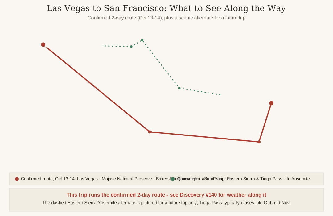
The itinerary is confirmed and isn’t up for debate: Ken stays in Las Vegas through October 12, drives to Bakersfield, California on October 13 for an overnight stop, and arrives in San Francisco on October 14. That's a real, OSRM-verified route — the same Route 4 already mapped in Discovery #139: Las Vegas to Kelso in Mojave National Preserve (93.3 miles, about 1 hour 56 minutes), Kelso to Bakersfield (130.3 miles, about 2 hours 32 minutes), and Bakersfield to San Francisco (281.8 miles, about 5 hours 18 minutes) — roughly 505 miles and 9 hours 50 minutes of driving, comfortably split into two days.
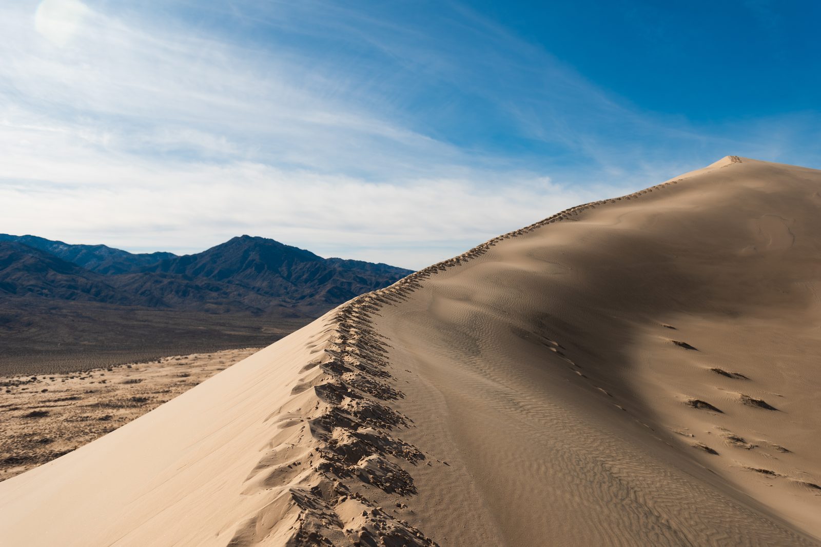
Mojave National Preserve — Kelso Dunes and the World’s Largest Joshua Tree Forest
Discovery #139 already covered Mojave National Preserve in detail as part of its own Route 4, so this won’t re-describe it at length — the short version, worth repeating because it’s the actual scenery for the first leg out of Las Vegas:
- The largest national preserve and the third-largest unit of the entire National Park System in the contiguous US, per Wikipedia
- Established in 1994 by the same California Desert Protection Act that created Death Valley National Park
- Kelso Dunes and the Cima Dome Joshua tree forest are the signature stops — the Cima Dome forest is described by Wikipedia as the largest and densest Joshua tree forest in the world
- One honest, already-flagged caveat: the historic Kelso Depot visitor center was still listed as temporarily closed for renovation as of Wikipedia’s most recent update when #139 checked it — the desert scenery itself is fully open regardless
Bakersfield, CA — the Overnight Stop, October 13
Bakersfield isn’t just a place to sleep between two more famous stops — it’s the real home of the “Bakersfield Sound,” the sub-genre of country music that Wynn Stewart pioneered and Buck Owens and Merle Haggard made famous starting in the mid-to-late 1950s, built as a reaction against Nashville’s slicker, orchestra-heavy productions. That heritage still shapes what’s worth seeing downtown:
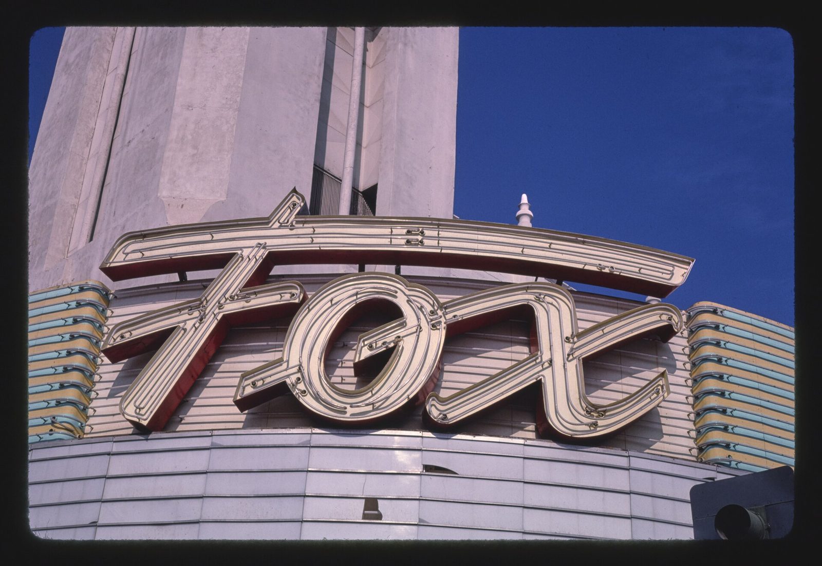
- Fox Theater — the historic downtown theater at 2001 H Street opened on Christmas Day 1930 with the sci-fi film Just Imagine. Its Type I poured-concrete-over-steel construction let it survive the destructive 1952 Kern County earthquake that leveled many other buildings in town, per Wikipedia. Its acts in the 1930s alone included Bakersfield-native Metropolitan Opera baritone Lawrence Tibbett and the Los Angeles Philharmonic Orchestra.
- Kern County Museum — a 16-acre Pioneer Village with more than 50 original historic buildings relocated from around the county, plus the Beale Memorial Clock Tower out front, itself rebuilt in 1964 after the same 1952 earthquake destroyed the original 1904 tower. Accredited by the American Alliance of Museums.
- California Living Museum (CALM) — a zoo and living museum founded in 1983, focused specifically on plants and animals native to California and Kern County, and accredited by the Zoological Association of America.
- Kern River County Park — a 1,012-acre recreation complex just north of downtown that includes Hart Memorial Park, its 370-acre, two-lake centerpiece with three canals and two 18-hole disc golf courses.
One honest, current correction worth flagging plainly: the Buck Owens Crystal Palace — the music hall and museum Buck Owens himself built in 1996, long the most obvious “Bakersfield Sound” stop in town — closed permanently in August 2025, per Wikipedia, after its overseeing foundation had been searching for a new buyer. It won’t be open for this trip, and it isn’t recommended here as a stop, despite showing up on older lists. The Bakersfield Sound heritage angle above (Fox Theater, and the genre’s own history) still holds; the Crystal Palace building itself just doesn’t anymore.
San Francisco, CA — Arrival, October 14, Plus the Extra Day
This is where the trip’s one spare day should actually go — not stretched across a third day of driving. San Francisco earns real weight here for exactly that reason:
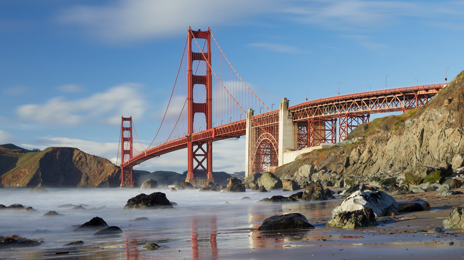
- Golden Gate Bridge — the suspension bridge spanning the mile-wide Golden Gate strait opened to the public on May 27, 1937, and is recognized by the American Society of Civil Engineers as one of the Wonders of the Modern World, per Wikipedia.
- Alcatraz Island — the former federal penitentiary, whose strong tidal currents and cold water made escape nearly impossible, closed as a prison on March 21, 1963, and now draws nearly 1.4 million visitors a year, per Wikipedia.
- Fisherman’s Wharf / Pier 39 — shops, restaurants, an aquarium, and the pier’s famous California sea lions hauled out on its marina docks, a genuinely family-friendly stop per Wikipedia’s own description.
- Golden Gate Park / California Academy of Sciences — among the largest natural history museums in the world, housing over 46 million specimens, rebuilt in 2008 under Renzo Piano’s famous “living roof.” A planetarium, an aquarium, and a rainforest exhibit all sit inside the same building, per Wikipedia.
- Muir Woods National Monument — a short trip across the bay in Marin County, just 12 miles north of San Francisco, protecting 240 acres of old-growth coast redwood forest, per Wikipedia.
A Totally Different Alternate — the Eastern Sierra and Yosemite via Tioga Pass, for a Future Trip
Not a pitch for this trip — a real option worth flagging for a future one, since it trades desert scenery for high mountains almost entirely. Discovery #139’s own Route 3 already covers the Eastern Sierra leg past Lone Pine in detail: the Alabama Hills, a range of rounded granite formations Wikipedia calls “a gateway to Mount Whitney and the Eastern Sierra Nevada,” laced with natural arches including the well-known Mobius Arch, plus Mount Whitney itself, the highest point in the contiguous US.
The difference here: instead of continuing north from Lone Pine toward Sacramento as #139’s Route 3 does, this alternate turns west into Yosemite National Park via Tioga Pass (CA-120) and drops down into San Francisco — a totally different look at the trip, mountains instead of desert, but a real detour that would push this leg well past the confirmed 2-day plan.
One honest, newly-checked caveat, sourced directly rather than assumed: per the National Park Service’s own historical Tioga Road closing-date records, the pass has closed anywhere from October 17 (2004) to as late as January in an unusually mild year, but the NPS’s own published statistics for 2004–2023 put the median closing date at November 14, with an average of November 17. That means Tioga Pass should typically still be open around October 13 in a normal year — but “typically” isn’t a guarantee this late in the season, and early closures do happen. Worth checking current road status at nps.gov/yose/planyourvisit/tiogaopen.htm or Caltrans QuickMap before actually committing to this route on any future trip.
The Actual Recommendation
For this trip: take the confirmed 2-day route through Mojave National Preserve and Bakersfield, exactly as planned. Don’t stretch it to three days to add the Eastern Sierra and Yosemite — that's a genuinely different, mountain-scenery trip better saved for its own future visit, especially with Tioga Pass's seasonal status never fully guaranteed this late in the year. The day that gets saved by keeping this a 2-day drive is better spent in San Francisco itself — the Golden Gate Bridge, Alcatraz, Pier 39, the California Academy of Sciences, and Muir Woods are all real, worthwhile stops that a rushed one-day arrival wouldn’t do justice to. That's the honest conclusion here, not a hedge: drive two days, then stay and see the city.